So, I have spent a couple of days making a tool called Maptools for a game that I play on Discord called Guess the City. As the name of the game suggests, the goal is to guess the city an image is taken in with as few guesses as possible. I am making a few small tools that display information on top of some maps I display using Leafletjs.
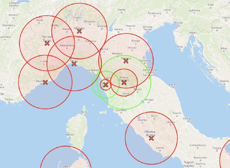
One of the main components of the game is that you have limited information. However, you do get 1 point of information with each guess: if you are in the correct country. You also get to know if you are within 100km, 50km, or 20km of the correct city. This distance information is what I originally made Maptools for: I wanted a way to display this information as a series of circles on a map to be able to triangulate the correct city. There do exist a couple of tools that let you do this, however, they all have their shortcomings: some have a tiny map on their page, some don’t have the correct database of cities, etc. So I combined a good large map with the correct cities and made my tool.
However, a series of other features quickly came to mind to enhance Maptools further. Thus far, I have implemented displaying all the possible cities as a layer on the map, some help for when setting the new city for when you win, a bulk input feature, and more features planned. I haven’t had this much fun developing something in years and think I’m not done with it for some time.
You can find Maptools on my github page: Maptools. Please know that it can take a while to load as it downloads a 75MB+ file containing all the cities in the world in order to provide a snappy response when using the tool.